How GPS Works: The Science of Satellite Navigation

Every time you summon a rideshare or hunt for a nearby restaurant, you rely on a network of atomic clocks screaming through the vacuum of space at fourteen thousand kilometers per hour. This invisible infrastructure ensures you never have to worry about being truly lost or missing a turn in an unfamiliar city.
Originally designed for Cold War battlefield coordination as NAVSTAR, the Global Positioning System has since transitioned into a public utility that manages global finance and emergency response. It functions through a delicate balance of orbital mechanics and relativistic physics where even the smallest calculation error would cause your location to drift by miles daily.
Key Takeaways
- Position is determined by measuring the time it takes for radio signals to travel from at least four satellites to a receiver. This method calculates distance by multiplying the signal travel time by the speed of light.
- Satellite clocks are programmed to run 38 microseconds slower per day than clocks on the surface to compensate for relativistic effects. Without this correction; location data would be inaccurate by several kilometers after just one day of operation.
- GPS receivers are strictly passive and do not transmit any data back to the satellite constellation. This allows an unlimited number of users to access the positioning network simultaneously without overloading the system capacity.
- Signal accuracy can be hindered by atmospheric interference or physical obstructions like skyscrapers and mountain ranges. These barriers cause signals to slow down or bounce, resulting in location errors known as multipath interference.
- Modern location services often combine GPS with other global networks like Galileo or GLONASS to improve reliability. This diverse network of satellites ensures that receivers can maintain a lock even in difficult environments with limited sky visibility.
The Three Pillars of GPS Architecture
The Global Positioning System consists of three distinct parts working in tandem to provide location data anywhere on the planet. This architecture ensures that the system remains reliable, accurate, and available to millions of users simultaneously.
By separating the responsibilities of space hardware, ground management, and individual hardware, the network operates as a seamless utility.
The Space Segment
The space segment consists of a constellation of satellites orbiting approximately 20,200 kilometers above the Earth. While the system originally required a minimum of 24 satellites to ensure global coverage, modern operations typically maintain 31 active units.
These satellites are distributed across six orbital planes, which are tilted relative to the equator. This specific arrangement ensures that at least four satellites are visible from nearly any point on the Earth’s surface at any time.
Each satellite circles the planet twice a day, continuously broadcasting radio signals that carry its current position and the exact time the signal was transmitted.
The Control Segment
The control segment acts as the operational brain of the entire network. It consists of a global network of monitoring stations and a Master Control Station located in Colorado.
These ground stations track the satellites as they pass overhead, measuring their distance and speed with extreme precision. If a satellite drifts slightly out of its predicted orbit, or if its onboard clock begins to deviate, the Master Control Station transmits corrective data back up to the satellite.
This updated information, known as ephemeris data, ensures that the satellite broadcasts its location with absolute accuracy to users on the ground.
The User Segment
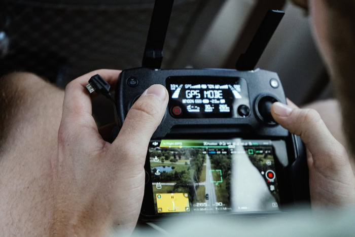
The user segment includes any device capable of receiving and processing GPS signals. This includes smartphones, vehicle telematics, and specialized surveying equipment.
Unlike two way communication systems like satellite phones, a GPS receiver is a passive device. It only listens to the radio signals broadcast from space; it never sends data back to the satellites.
Because the receiver does not need to transmit, the system can support an infinite number of users without becoming overloaded or requiring expensive transmission hardware in every handheld device.
The Geometry of Positioning: Trilateration

Positioning relies on geometric principles to turn radio signals into coordinates. By measuring how long it takes for a signal to travel from a satellite to a receiver, the system calculates the distance between the two points.
This process builds a mathematical foundation for locating a specific point on the surface of a three dimensional world.
Trilateration and Triangulation
While people often confuse the process with triangulation, GPS uses a method called trilateration. Triangulation involves measuring angles to determine a location, but trilateration relies exclusively on distance.
A receiver calculates its distance from a satellite by multiplying the speed of light by the time it took for the signal to arrive. If a receiver knows it is exactly 20,000 kilometers from a specific satellite, it knows it is somewhere on the surface of an imaginary sphere with a radius of 20,000 kilometers centered on that satellite.
The Intersection of Spheres
A single distance measurement only places the user on the surface of a massive sphere. When a second satellite signal is added, the intersection of the two spheres creates a circle.
Adding a third satellite creates two points where all three spheres intersect. Usually, one of these points is far out in space or deep underground, allowing the receiver to disregard it and identify the correct location on Earth.
Although three satellites are enough to find a latitude and longitude, a fourth is necessary for practical application.
The Necessity of the Fourth Satellite
The fourth satellite is required to correct for timing errors. While satellites carry incredibly accurate atomic clocks, most handheld receivers use inexpensive quartz clocks that are not perfectly synchronized with the satellites.
Even a microsecond of error would result in a location mistake of hundreds of meters. By receiving a fourth signal, the receiver can solve a mathematical equation with four unknowns: latitude, longitude, altitude, and time.
This fourth measurement allows the receiver to reset its internal clock to match the atomic time of the satellites, ensuring high precision for the user.
Precision Timing and the Role of Relativity
Atomic clocks are the foundation of GPS accuracy. Because light travels at roughly 300,000 kilometers per second, even a tiny timing error has massive consequences for distance calculations.
To maintain the necessary precision, every GPS satellite carries multiple rubidium or cesium atomic clocks. These instruments use the vibrations of atoms to keep time within nanoseconds, providing the stability required for meter level accuracy on the ground.
Atomic Clocks in Orbit
Each satellite relies on these high precision clocks to timestamp the signals it sends to Earth. The receiver compares the time the signal was sent with the time it was received to determine the distance.
Because the speed of light is a constant, any variation in the clock’s frequency would result in an immediate loss of accuracy. The use of multiple clocks on each satellite provides redundancy, ensuring that the system remains functional even if one clock fails.
Einstein’s Special Relativity
The high speed of the satellites introduces a phenomenon described by Einstein’s theory of special relativity. Because the satellites move at approximately 14,000 kilometers per hour relative to the Earth, time for them appears to move more slowly compared to observers on the ground.
This effect causes the satellite clocks to lose about seven microseconds every day. Without compensation, this shift would cause the entire positioning system to fail within hours.
General Relativity and Gravity
General relativity introduces a second, opposing effect based on gravity. Earth’s gravity is much weaker at the altitude where satellites orbit than it is on the surface.
According to general relativity, clocks in weaker gravity tick faster. For GPS satellites, this means their clocks gain about 45 microseconds per day.
When combined with the loss from special relativity, the clocks have a net gain of 38 microseconds per day. Engineers program the satellite clocks to tick slightly slower before they are launched to ensure they remain perfectly synchronized with clocks on Earth.
Factors Affecting Signal Integrity and Accuracy

Even with perfect satellite hardware, the journey of a radio signal through the atmosphere introduces variables that can degrade accuracy. These signals must pass through different layers of air and navigate physical obstacles on the ground before they reach a receiver.
Atmospheric Interference
As GPS signals enter the Earth’s atmosphere, they pass through the ionosphere and the troposphere. These layers contain charged particles and water vapor that refract radio waves, effectively slowing them down.
This delay mimics a longer travel distance, which can cause a receiver to calculate a position several meters away from its true location. Modern receivers use mathematical models and atmospheric data to compensate for these delays, but heavy solar activity or extreme weather can still impact signal quality.
The Urban Canyon Effect
In cities, tall buildings and glass structures create a phenomenon known as the urban canyon effect. Instead of traveling in a straight line from the satellite to the receiver, signals often bounce off buildings first.
This is called multipath interference. Because the reflected signal takes a longer path than a direct signal, the receiver calculates an incorrect distance.
This often results in the jumping effect seen on navigation maps where a vehicle appears to be on a parallel street or inside a building.
Signal Blockage and Physical Limits
Radio signals from GPS satellites are relatively weak by the time they reach the surface, making them easily blocked by solid objects. Dense tree canopies, mountains, and concrete structures can weaken or completely obstruct the signal.
This is why GPS does not work inside tunnels, deep underwater, or in the basements of large buildings. In these environments, the receiver cannot maintain a line of sight with the minimum number of satellites required to calculate a position.
Modern Enhancements and the Global GNSS Network

Technology has evolved to overcome many of the traditional limitations of satellite navigation. Newer hardware and collaborative networks now allow for faster signal acquisition and better performance in difficult environments.
These advancements have expanded the utility of location services far beyond the original capabilities of the system.
Assisted GPS
Standard GPS can sometimes take several minutes to determine a location from a cold start. Assisted GPS, or A-GPS, solves this by using mobile phone networks to provide initial data.
By downloading satellite orbital information via a cellular or Wi-Fi connection, a smartphone can find satellites much faster than it could by scanning the sky alone. This technology significantly reduces the time to first fix, allowing for nearly instant positioning when an application is opened.
Dual Frequency GPS
Traditional GPS receivers primarily use a single frequency known as L1. Newer devices now utilize a second frequency called L5.
By comparing the signals from two different frequencies, a receiver can calculate and remove the errors caused by atmospheric interference more effectively. This dual frequency approach also helps the receiver distinguish between direct signals and reflections, which improves accuracy in dense urban areas where multipath interference is common.
Beyond GPS: The GNSS Ecosystem
While GPS is the most recognized system, it is only one part of the Global Navigation Satellite System (GNSS). Other nations have developed their own constellations to ensure technological independence and improve global accuracy.
Russia’s GLONASS, the European Union’s Galileo, and China’s BeiDou provide additional satellites for modern receivers to track. Most contemporary smartphones are designed to use signals from multiple constellations simultaneously, providing more reliable coverage and higher precision than GPS could provide on its own.
Conclusion
The Global Positioning System represents a triumph of engineering that merges atomic precision with geometric logic. By maintaining a synchronized constellation of satellites, the system provides a constant stream of data that allows receivers to solve complex spatial equations in milliseconds.
It is no longer just a tool for finding directions; it has become a fundamental component of global infrastructure. Power grids use the timing provided by the system to synchronize electrical flow, while international banking systems rely on its nanosecond accuracy to timestamp trillions of dollars in transactions.
From the rapid dispatch of emergency services to the automated landing of commercial aircraft, this orbital network serves as a silent, essential utility that maintains the rhythm of modern life.
Frequently Asked Questions
Why does my GPS sometimes think I am a block away from my actual location?
This error is usually caused by signals bouncing off tall buildings or glass before reaching your phone. Known as the urban canyon effect, this extra travel time tricks the receiver into thinking the satellite is further away than it is. This delay causes your position to jump on the map.
Does using GPS on my phone use up my cellular data?
No, standard GPS does not require a data connection because your phone only listens for radio signals from satellites. However, your phone might use a small amount of data for Assisted GPS to download satellite locations more quickly. Without data, the initial connection just takes a few minutes longer.
Why does my phone need four satellites instead of just one?
Four satellites are needed to provide a three dimensional location and synchronize your phone clock with the atomic time in space. While three signals can find your latitude and longitude, the fourth resolves the altitude and removes any timing errors. This ensures your location is precise to within meters.
Will GPS still work if there is no cell service or internet?
Yes, your device will still receive satellite signals even in remote areas without any cellular coverage. While you may not see a detailed map without an internet connection, your phone can still calculate your exact coordinates. Many outdoor navigation apps allow you to download maps for use in these situations.
Why do the satellites need atomic clocks?
Atomic clocks are necessary because GPS signals travel at the speed of light, meaning a timing error of one microsecond causes a 300 meter location error. These clocks use the vibrations of atoms to maintain precision within billionths of a second. This level of accuracy is the only way to provide reliable navigation.


